|
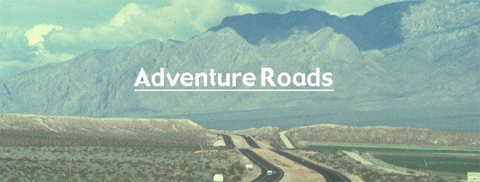
Roads
to
Adventure
Yellowhead
Alaska
Hwy
Rogers
Pass
Okanagan
Columbia
Icefields
Pkwy
Goldrush
Trail
Pacific
Route
99 and 1-5
Sea
to
Sky
Trans
Canada Yellowhead
Winnipeg
Portage
la
Prairie
Neepawa
Minnedosa
Yorkton
Saskatoon,
Battlefords
Lloydminster
Parks
Map
Vegreville
Elk
Island Park
Edmonton
Edson
Hinton
Jasper
Prince
George,
Smithers
Terrace
Prince
Rupert
Queen
Charlottes
Kamloops
Merritt
Hope
BC-Alberta- Alaska
highways
map
marine
map
railways
map.
|

|
|
Come
out O Little Mocassins and frolic on the
snow
Come out O tiny beaded feet and twinkle in
the light
I'll play the old Red River reel, you used
to love it so,
Awake, O Little Mocassins and dance for me
tonight.
Robert W. Service
|
|
 I I
I
am the Yellowhead ...
by Jerry
W. Bird
My vast domain
spans half of Canada, the world's second largest
country, with ports facing three great oceans. I
follow the trails of natives and voyageurs westward
from Lake Winnipeg and the forks of three historic
rivers to the misty *Haida Gwa'ii, where British
Columbia meets the North Pacific. Near majestic
Mount Robson, Canada's highest peak, my second
branch meanders south via Kamloops to Hope, gateway
to the Fraser Valley. Crossing me is a journey into
history, with Indian encampments older than Egypt's
great pyramids, pristine national and provincial
parks, ancient shrines and battle sites. Ethnic
dances and pageants salute every facet of Canada's
heritage, and if you love the magic of serendipity,
a new surprise awaits around each bend. If you find
some parts of the country a l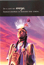 ittle
"behind the times " ... a popular Saskatchewan
Tourism poster says, "Count yourself lucky. You've
discovered the true Canada." Get a copy of my
official Road Map, or a reasonable facsimile?
Stretch it out on the table or across the hood or
your vehicle. Glancing from east to west, you'll
see that my eastern terminus is Winnipeg, Manitoba
at the foot of two large lakes. Tracing my path
westward, I parallel the North Saskatchewan River
to Edmonton, and follow the Athabaska River into
Jasper National Park, Canada's Rocky Mountain
playground. Further west near Mount Robson, I give
motorists the option of heading directly west via
Prince George, or south via Kamloops to the town of
Hope at the entrance to the Fraser Valley and port
of Vancouver. On these segments I follow the North
Thompson, the Mighty Fraser and Skeena
Rivers. ittle
"behind the times " ... a popular Saskatchewan
Tourism poster says, "Count yourself lucky. You've
discovered the true Canada." Get a copy of my
official Road Map, or a reasonable facsimile?
Stretch it out on the table or across the hood or
your vehicle. Glancing from east to west, you'll
see that my eastern terminus is Winnipeg, Manitoba
at the foot of two large lakes. Tracing my path
westward, I parallel the North Saskatchewan River
to Edmonton, and follow the Athabaska River into
Jasper National Park, Canada's Rocky Mountain
playground. Further west near Mount Robson, I give
motorists the option of heading directly west via
Prince George, or south via Kamloops to the town of
Hope at the entrance to the Fraser Valley and port
of Vancouver. On these segments I follow the North
Thompson, the Mighty Fraser and Skeena
Rivers.
 Canada's
Historic Route. To begin your journey down my
pathway to pleasure, imagine your auto or RV is a
time-capsule, as you cruise along this broad ribbon
of Canadiana, in the wake of nomadic hunters,
voyageurs, missionaries, traders, sodbusters,
fortune-seekers and railroad builders. Before we
dim the lights and start the movie, you're curious
to know how the name Yellowhead was derived --
right? In the 1870s, a roving Iroquois Metis guide,
dubbed Tete Jaune for his golden locks, gave title
to a mountain pass near Jasper House, and gained
instant immortality. Fly-Drive Holidays are all the
rage, in an age when time has become more valuable
than money. You can fly the "Air Highways" to
dozens of gateway airports from east to west, then
take your pick of ground transport, be it an
automobile, van or RV rental or Via Rail Canada's
Yellowhead- Skeena Route to Prince
Rupert. Canada's
Historic Route. To begin your journey down my
pathway to pleasure, imagine your auto or RV is a
time-capsule, as you cruise along this broad ribbon
of Canadiana, in the wake of nomadic hunters,
voyageurs, missionaries, traders, sodbusters,
fortune-seekers and railroad builders. Before we
dim the lights and start the movie, you're curious
to know how the name Yellowhead was derived --
right? In the 1870s, a roving Iroquois Metis guide,
dubbed Tete Jaune for his golden locks, gave title
to a mountain pass near Jasper House, and gained
instant immortality. Fly-Drive Holidays are all the
rage, in an age when time has become more valuable
than money. You can fly the "Air Highways" to
dozens of gateway airports from east to west, then
take your pick of ground transport, be it an
automobile, van or RV rental or Via Rail Canada's
Yellowhead- Skeena Route to Prince
Rupert.
 A
Taste of Canada. I appeal to nature lovers and
adventurous souls with a taste for the finer
things. So, get out the fishing rod, thermos jug
and picnic basket! This great drive might easily be
called a Great Canadian Taste Tour. Why? -- the
Yellowhead crosses and parallels famous rivers and
nameless streams, skirts many lakes great and
small, visits orchards, ranches, farmers markets
and unique dining spots. You can feast on Winnipeg
Goldeye, rainbow trout, Pacific salmon, Alaska king
crab, oysters, mussels and clams, prairie chicken,
moose steak, buffalo burgers, award-winning Alberta
beef and Okanagan wines. Add the world's finest
cereal grains and 1001 varieties of ethnic fare --
how near to heaven can you get? And if you like to
sing on long car trips, there's always a
cinemascopic backdrop to enhance the performance;
prairie skies, tumbleweed, moose
pasture,.
More A
Taste of Canada. I appeal to nature lovers and
adventurous souls with a taste for the finer
things. So, get out the fishing rod, thermos jug
and picnic basket! This great drive might easily be
called a Great Canadian Taste Tour. Why? -- the
Yellowhead crosses and parallels famous rivers and
nameless streams, skirts many lakes great and
small, visits orchards, ranches, farmers markets
and unique dining spots. You can feast on Winnipeg
Goldeye, rainbow trout, Pacific salmon, Alaska king
crab, oysters, mussels and clams, prairie chicken,
moose steak, buffalo burgers, award-winning Alberta
beef and Okanagan wines. Add the world's finest
cereal grains and 1001 varieties of ethnic fare --
how near to heaven can you get? And if you like to
sing on long car trips, there's always a
cinemascopic backdrop to enhance the performance;
prairie skies, tumbleweed, moose
pasture,.
More
|
There's
a land where the mountains are
nameless
And the rivers all run, god knows
where.
There are lives that are erring and
aimless
And deaths that just hang by a hair.
There are hardships that nobody
reckons
There are valleys unpeopled and still
There's a land, how it beckons and
beckons
And I want to go back, and I will.
Robert W. Service
|
|
|
 Alaska
Highway celebrates 60
Years Alaska
Highway celebrates 60
Years
Imagine you are a time traveler. The year is 1942.
The month is February - and our whole world is
gripped by total war. For the moment, Axis forces
hold the initiative, and for weeks following the
Pearl Harbor disaster, every ship leaving North
America's Pacific ports is threatened. The
president's directive is clear: Furnish a supply
route to the network of northern airfields - an
overland route to supplement our air and sea lanes;
one secure from attack." Approval comes swiftly,
and the task begins, with end points set up by the
military at Dawson
Creek,
BC. and
Big Delta, Alaska. Overnight, the entire North
mobilizes, as the rugged Trail of '42 rivals the
famous Trail of '98 in worldwide focus. Those of us
living in the Yukon at the time felt suddenly in
the forefront of the action. What some called North
America's greatest construction project since the
Panama Canal began as a marvel of mobility at the
time. U.S. Authorities combed the entire coast,
seeking available water transportation, creating a
patchwork flotilla of yachts, cargo vessels, tugs
fish boats and barges.
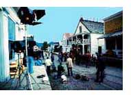
This story is
from the opening of a half hour commemorative
video, written by Jerry W. Bird for the Canadian
Government as a salute to the Alaska Highway's 50th
Anniversary. See
photos taken during construction phase
The Alaska Highway was also a massive sea-bridge,
spanning the coastal fjords of the Inside Passage
to historic Skagway, then over the White
Pass by
narrow-gauge railway to Whitehorse on the Yukon
River, or up-coast to Valdez, Alaska, near
Anchorage. Inland, a 500-mile connection existed
via rail and dirt road, from Edmonton to the
staging point at Dawson Creek, BC. Mere dots on the
map soon became feverish anthills of activity, as
mountains of supplies and acres of equipment were
stockpiled along the way. The fleet
of paddle wheelers that plied the Yukon since the
Gold Rush of the 1890s was pressed into service,
since there were no real roads connecting the
territory's main communities. More-
Explore
BC's Gold Rush Trail
In the 1850s,
BC's Gold Rush drew prospectors from around the
world, most of whom made their way by various forms
of conveyance, up the Mighty Fraser, from its mouth
near Sea Island (Richmond) to the head of
navigation at Yale. North of Hope, the is a rugged
stretch or road and trail that hugs the shoulders
of the Fraser Canyon, as down below, the foamy
white rapids churn and roar. Places to visit along
the way include Hope, Hell's Gate with its famous
Air Tram, Spuzzum, Boston Bar, Lytton, Lillooet
(original Mile 0 of the Cariboo Trail) and a string
of frontier towns.
We visited
the historic Fraser Canyon again last summer,
heading west from Merrit to Spence's Bridge, and
took the time to truly appreciate the awesome
scenery. You can see how challenging it was for the
gold prospectors in their difficult quest. This
route between Hope and Cache Creek is a 'great
drive' experience you'll never forget, with its
sharp turns, railway tunnels, historic sites and
exciting view points. So take your time, and don't
forget to stop and smell the flowers. They were
blooming on every hillside on our last
trip.
More->
|
|
Great
Drives to Canada's Hot Springs
Heaven
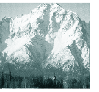
The eternal
icefields wear a "necklace of thermal springs", fed
from water trapped in fissures and caverns deep in
the roots of the Rockies. Raging rivers, glutted by
the seasonal runoff, churn and boil like some
concoction from a giant soda fountain. Oh the joys
of steamy, bubbly-hot, sulfur-scented waters; Solus
Par Aqua (health by water) to the Romans; a sacred
rite to Canada's native peoples, and Shangri-La to
we hot springs fanatics. Speaking of natural spas,
the Kootenays have them in spades; Ainsworth,
Halycon, Nakusp, Ram Creek and Wild Horse. Many of
these natural spa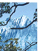 s
along the Columbia Valley and Continental Divide
are so enticing, you'll want to stop the car right
there and take the plunge.
More-> s
along the Columbia Valley and Continental Divide
are so enticing, you'll want to stop the car right
there and take the plunge.
More->
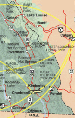
East
Kootenays and Columbia Valley to Golden, Banff and
Jasper
You can relax at one of the local hot spring
resort locations, such as Fairmont Hot Springs,
which has four pools with an average temperature of
40 degrees Celsius or Radium Hot Springs, with two
springs averaging 35 degrees, both north of
Cranbrook on Highway 95. Nearby and hottest of all
is Lussier Hot Springs near Canal Flats, whose
waters hit a healthy 44 degrees.
.Map of river and area below
shows access via airports and highways..
Click for map
|